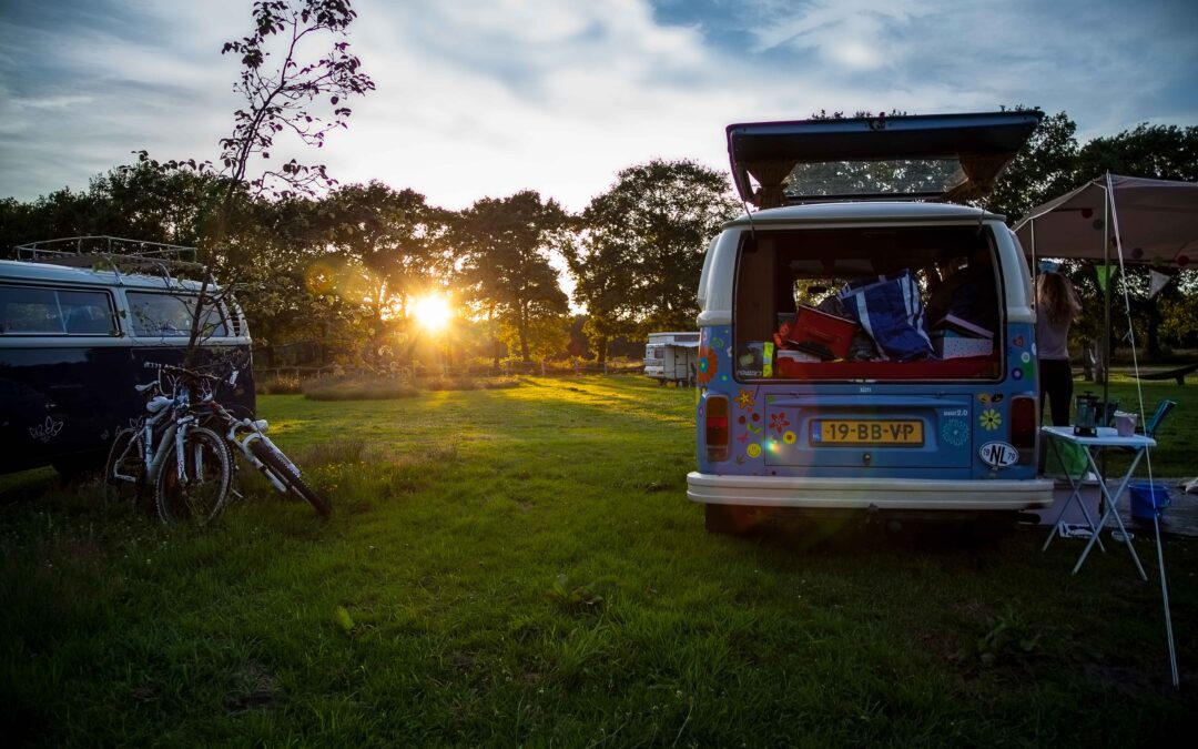
Helga slams the car door shut with a loud bang. Sweat trickles down her forehead and her breathing is rushed. I react to the bang, I let the clutch come up and we immediately start moving. We can hear the branches swishing around us when we drive through the fruit trees. When we reach the main road we can finally pick up the pace. A few days earlier we heard that one of the roads leading us out of Montagu will be closed entirely due to roadworks. This road is our only way of getting where we want to go without having to drive many more kilometres.
When Helga’s breathing is back to normal she starts to prepare for her role as navigator. She suddenly looks at me and asks: “Where are the maps?” I try to divide my attention, not my strongest skill, and wreck my brain where those maps are while driving through a busy pass. I can see both of us running out of the small reception area while the sprinklers try to liven up the sad looking grass and we try to avoid getting wet. We’ve used the maps to get information from the owners of the campsite, who just recently moved here from Botswana. The maps are probably still there…At the same moment I can tell that Helga has reached the same conclusion. This is one of those moments where you wish the cabin of the car was a bit bigger. We make a u-turn and pass the long row of cars trying to get out of town while we drive back to the campsite where we eventually find our precious maps. We now know the way and decide to try our luck again. We end up being one of the last cars to get through before they close the road to start the explosions to improve the road. We are very lucky, but it still takes about 20 minutes before Helga talks to me again. We are now on the most southern point of the continent of Africa: Cape Agulhas.
Stellenbosch March 24, 2016 Even though we’re 10.000 km from home, we sometimes feel like we’re at home. In Montagu we met some climbers: Canadian Becky and South African Johann. They invite us to their home in Stellenbosch, an offer we don’t have to think on for very long. Over the next few days we stroll through pitoresque Stellenbosch with friends, we run, climb, go to pubs and walk through Franschoek NP.
The sun rises and the rays of light find their way through the tiny little holes in the mosquito net. I turn around on my stomach and look out over the riverbed where we camped. The footprints from our nightly visit are clearly visible from the tent.
They lead to the water where they disappear. I get myself out of my warm sleeping bag and get dressed in the same clothes as the days before. My shirt is starting to get stiff from dust and sweat. My legs look tanned, but are actually covered in dust. I get down the ladder backwards and walk towards the tracks. My foot fits in it 5 times. I follow the steps towards the small stream, and can see they continue through the river away from our camp. I walk back to the tent, when Helga just comes out of it. I take the dusty towel which hangs on the ladder, look for the soap en walk back to the river. Time for a little wash.
When I walk back, all washed, the coffee is ready and the map is spread out over the breakfast table. While I am leaning over the map and are tracing the riverbed north, Helga grabs my elbow:” Look, they are back!”. I look up and see a small herd of elephants slowly walking our way. They also see us and are clearly hesitating to come any closer. They decide to change their course and stay at a distance. We pack up our tents quickly, finish our breakfast and are on our way. Via the riverbed, partly through the river itself, we drive north. We haven’t traveled far before we see another amazing sight: a large mother elephant with a newly born calf.
We leave the river behind and start on a deserted piece of desert. The ground looks covered with small black strips and is seemingly endless. It reminds me a bit of my trip through the Gobi desert in Mongolia. Except for the view in the distance, it is very similar. Luckily we are now traveling with two well equipped cars instead of riding my motorcycle solo. The desert slowly turns in to the familiar Savannah and it’s not long before we see the first animals. It starts with springbokken, widly spread out over the vast area, and later on a herd of gemsbokken. We stop for a little while when we see an enormous giraffe.
That night we find our camp spot in a dried out river. We start to make a fire and make a fire pit out of stones lying around. As the fire gets hotter the stones we so carefully selected out of the riverbed, start to explode. Pieces shoot away from the burning fire and force us to sit at a safe distance. Luckily our cars are away far enough and safely in our rooftop tent the exploding stones keep us awake for some time.
We don’t have to set the alarm, the sun burns us out of the tent anyway. The ladder of the tent sits in the loose sand and the fire still smokes a little bit. Slightly neurotic I scan the ground around our car for fresh tracks. I don’t see any. Satisfied I pull the salami out of the fridge for breakfast.
We put the coordinates for a waterhole in our navigation. Waterholes are often meeting places for different types of animals. A dry riverbed leads us to it. This riverbed is particularly sandy and the cars have to work hard to get through. It helps to be with two cars where one can follow the tracks from the first.
From behind a large tree and a curtain of leaves we get looked at by a large male elephant. He turns himself towards the cars the moment we pass him. He see him move rather nervously and his large ears move front to back. We leave him be and drive on slowly. We don’t have to wait much longer before we’re in luck again: a group of giraffes are gorging on the green trees on the side of the riverbed. The cars don’t really seem to bother them.
We leave the riverbed, drive for hours through the rocky desert and end up at another riverbed, but this time it has water. Recent car tracks prove that it is possible to drive through it. A narrow gap in the rock gives us enough cover to set up camp. We make a large fire to keep the animals and flies at a distance. We also cook on the fire and go to bed early while the fire still burns a little bit.
A low rumble gets me out of my sleep, it is 12 o’clock. I can hear it’s close. I squeeze Helga’s arm and she wakes up quickly. I stare out of our roof top tent into the darkness. Helga also turns her gaze outside, but we both see nothing, it is pitch black. Slowly our eyes adjust to the dark. We can feel the ground underneath the car tremble when the large thing moves: An enormous elephant, less than 4 meters away from the car. Silently we stare outside. We can hear it munching on the trees next to us. My heart is in my throat. My eyes are now even better adjusted to the dark and I can see a dark shadow. A deep rumble, next to our tent, we can almost smell its breath. We can feel the wind when it turns around and elegantly, without touching anything, it walks past the car in the direction of the water. We look at each other and take a breath. It takes a little while before we fall asleep again.
Back to all blogs
The sun comes up slowly and the first rays of light manage to get through the thick layer of dust. We’ve been awake for a while and are sitting on narrow wooden benches with our freshly brewed coffee and the map. The sun heats up our surroundings quickly and the heat plus the caffeine helps us to get going.
We pack up the tent, put the cutlery in its place and wash our plates. The sun shines down on our windscreen and we can see our reflections in the dusty window.
I’ve been on the road for almost 2 years, my hair has grown and now sits in a ponytail at the back of my head. It’s more convenience than fashion. The hairs on my chin form a messy beard. My nose and shoulders are raw and red because of the sun and my lips have deep creases. They hurt from time to time and start bleeding when I smile. I’m walking on my bare feet which have callusses and are brown from the dust. There is a faint trace of white on them: my flipflops. My hands are also dry and the tips of my fingers shed their skin due to physical work and the dry climate. I smile at my reflection and get behind the steering wheel.
We are now in the Northern part of Namibia, Kaokaland, and on our way to Sesfontein. Sesfontein is a dusty “town” cut in two by a broad sandy road full of corrugations. The first shed we pass has a hand made sign that says: Tyre repair shop. The door consists of an old shower curtain. An old CocaCola refrigerator fills the room and some men are sitting outside waiting for work. Unfortunately for them our tyres have survived the trip. The next shed has a sign in the same handwriting and says: “Bar”. Too early for that. A police car races by and leaves us in a cloud of dust, we even have to stop to let it clear up around us. We drive past another tyre repair shop with the same handwritten sign. It shows that people can actually make a living out of the bad roads surrounding Sesfontein.
We turn off into a small road that leads us to a fuel station. We are meeting a German couple here, Stefan and Annette, who have been on the road for two years now with their Mercedes G Wagon (The Beast), the same car that the Dutch and Australian army uses. Together we will travel through the more remote northern part of Namibia. This is a place where it is better to travel with multiple vehicles. It is dry, hot, navigating is a pain and you will have to prepare for days without getting groceries, fuel or water.
We know them from an earlier meet up in Capetown and are looking forward to the trip.
Together we drive west towards the Skeleton Coast. Alongside the road we see small huts made out of clay, where whole families live. The dogs, cows, goats and sometimes pigs reluctantly leave the road to make way for us. The women are usually dressed traditionally, with dark red clay on their skin and bare breasts. The men wear t-shirts with a traditional cloth around their waists which kind of looks like a coloured diaper. We drive on GPS coordinates and leave the small huts behind. The road is very corrugated with loose sand on top which makes for heavy dust clouds, but also makes it a bit more comfortable to drive on.
A white sedan in the middle of the road slows us down. Two men come running at us when they see us approach and gesticulate animately. As soon as I roll down my window it becomes clear that they broke down and that they want us to tow them out. I get out of the car to get a better look at the situation. This is a very deserted road and the men have been waiting for help for most of the day. The tracks in the sand show us that they tried to push the car out, but had no luck. Eventually we decide to tow the car for a little while to get it out of the thickest sand and hopefully to start again. It takes a little while but in the end we manage. The car runs again and we leave it and the two men behind so they can continue on their own on the sandy track: destination unknown.
We turn off again, onto an even smaller track. After a while we have to stop on the side of the road because of a car coming from the opposite direction. Through the open window we exchange pleasantries. A very large antenne on the roof of the sand coloured Landcruiser points to the fact that this is not just your average car. The man behind the wheel, with a tanned skin and a long white beard acknowledges this. He is a biologist and tells us that he works in this area and that he studies the lions here. We drive on slowly after meeting him. The moment we see a tree which has been trampled and eaten by an elephant we stop to collect firewood. The idea of having a fire seems like a very good idea now we know there are lions around.
A large rock wall protects us from the wind that night. The sky is very clear and the stars light up everything. Mesmerized we stare up until the cold forces us to bed. The red glow of the fire coloures the inside of our tent scarlet. It gives us a safe feeling, Even if it’s for a little while until we fall asleep.
Back to all blogs
The early morning glow slowly colours in our surroundings. It is early and we are on our way to the Namibian border. We park in front of the border office, get out of the car and smile at each other when we see the numbered offices: 1 til 6. All different cubicles for different authorities. We prepare for the worse. But surprisingly we find ourself walking from office to office in no time. Before we know it our passports are stamped, the car is checked and we’re driving into Namibia.
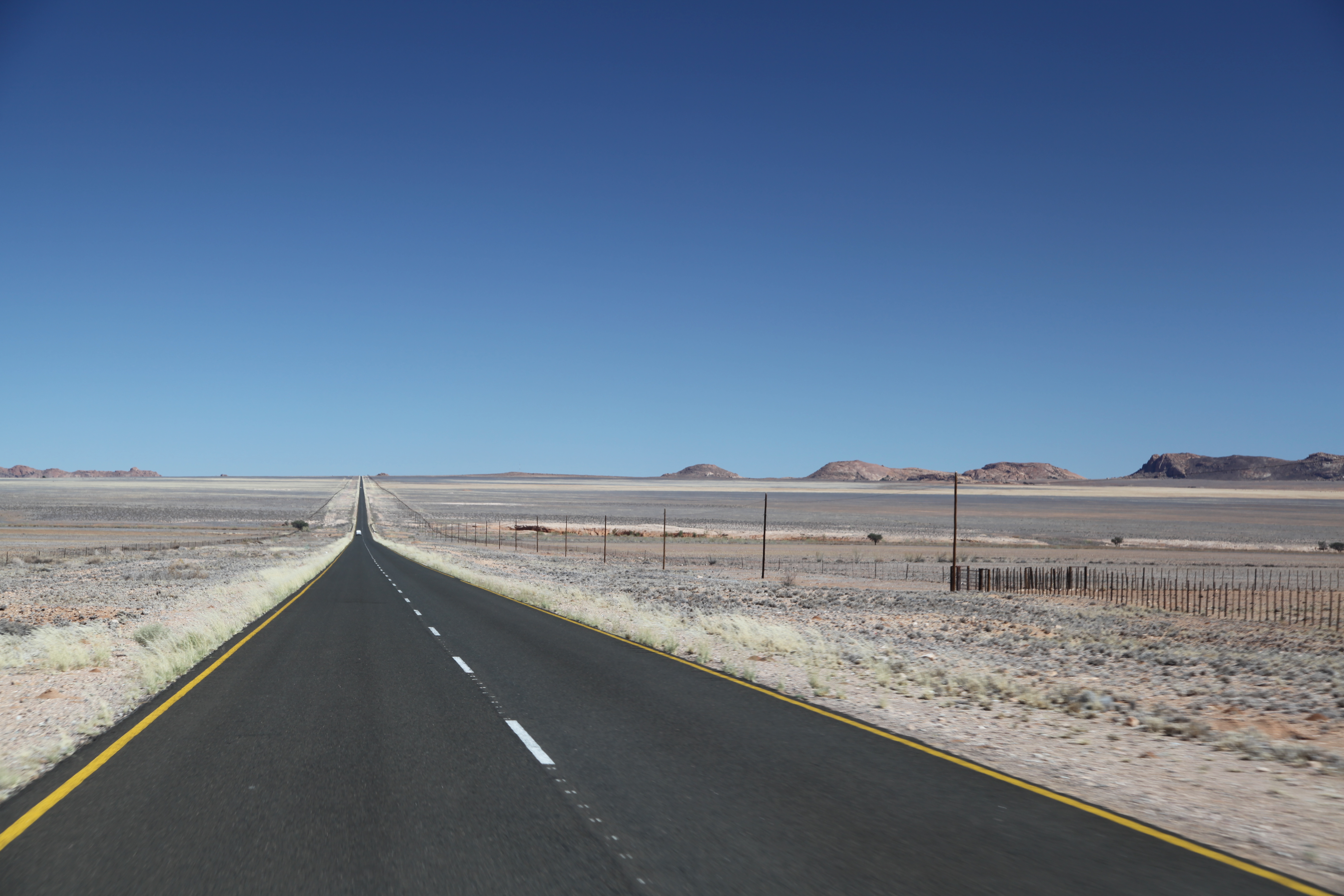
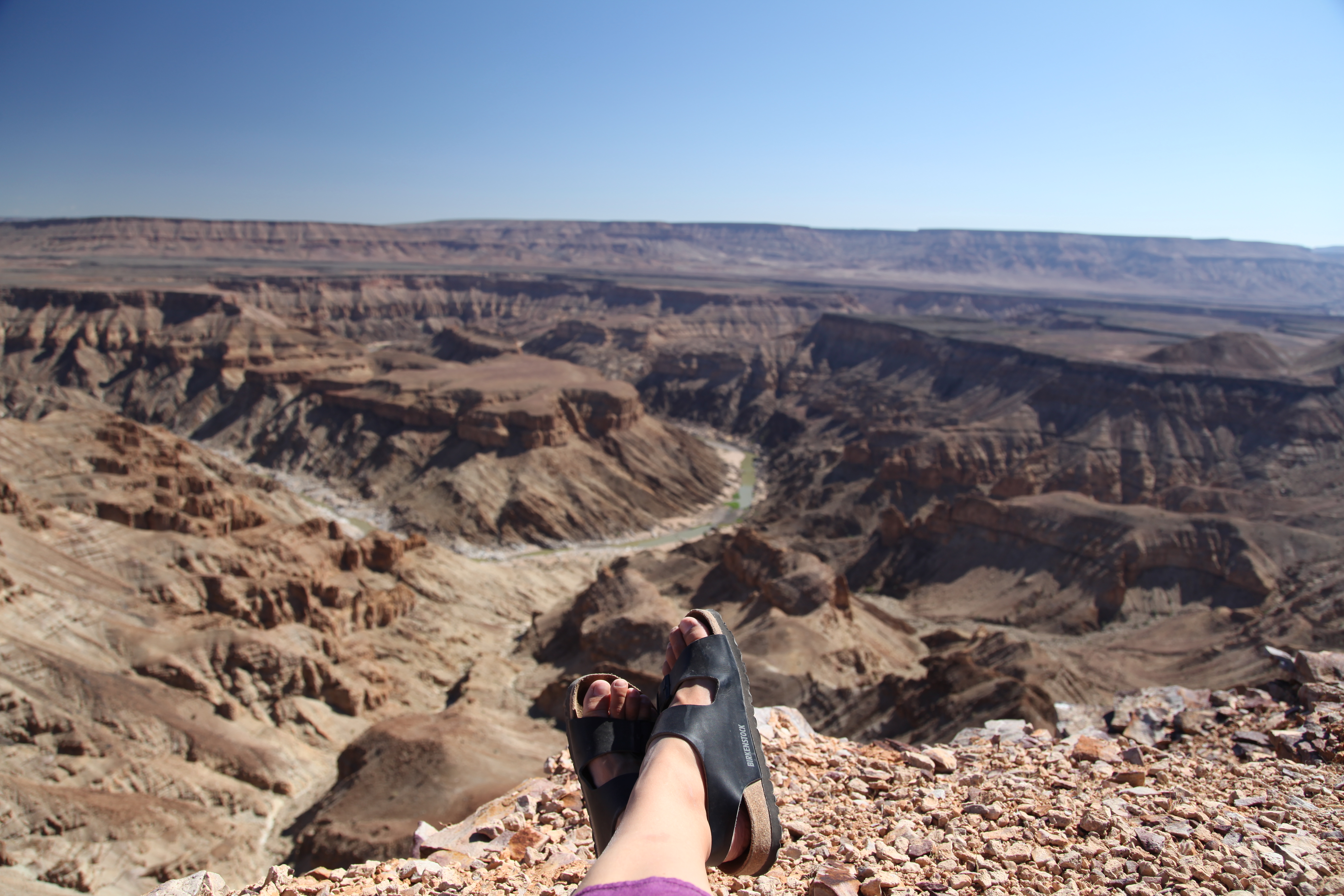
Our first impression is: empty. It is dry and the views seem endless. We drive passed the first small villages and directly to Fish River Canyon and the Ai-Ais Hotsprings.
The Fish River Canyon (Afrikaans: Visrivier Canyon or Visrivier Afgronde, German: Fischfluss Canyon), is located in the south of Namibia. It is the largest canyon in Africa, as well as the second most visited tourist attraction in Namibia. It features a gigantic ravine, in total about 100 miles (160 km) long, up to 27 km wide and in places almost 550 meters deep. The Fish River is the longest interior river in Namibia. It cuts deep into the plateau which is today dry, stony and sparsely covered with hardy drought-resistant plants. The river flows intermittently, usually flooding in late summer; the rest of the year it becomes a chain of long narrow pools. At the lower end of the Fish River Canyon, the hot springs resort of Ai-Ais is situated. Public view points are near Hobas, a camp site 70 km north of Ai-Ais. This part of the canyon is part of the Ai-Ais/Richtersveld Transfrontier Park. The other 90 km of this canyon are privately owned.
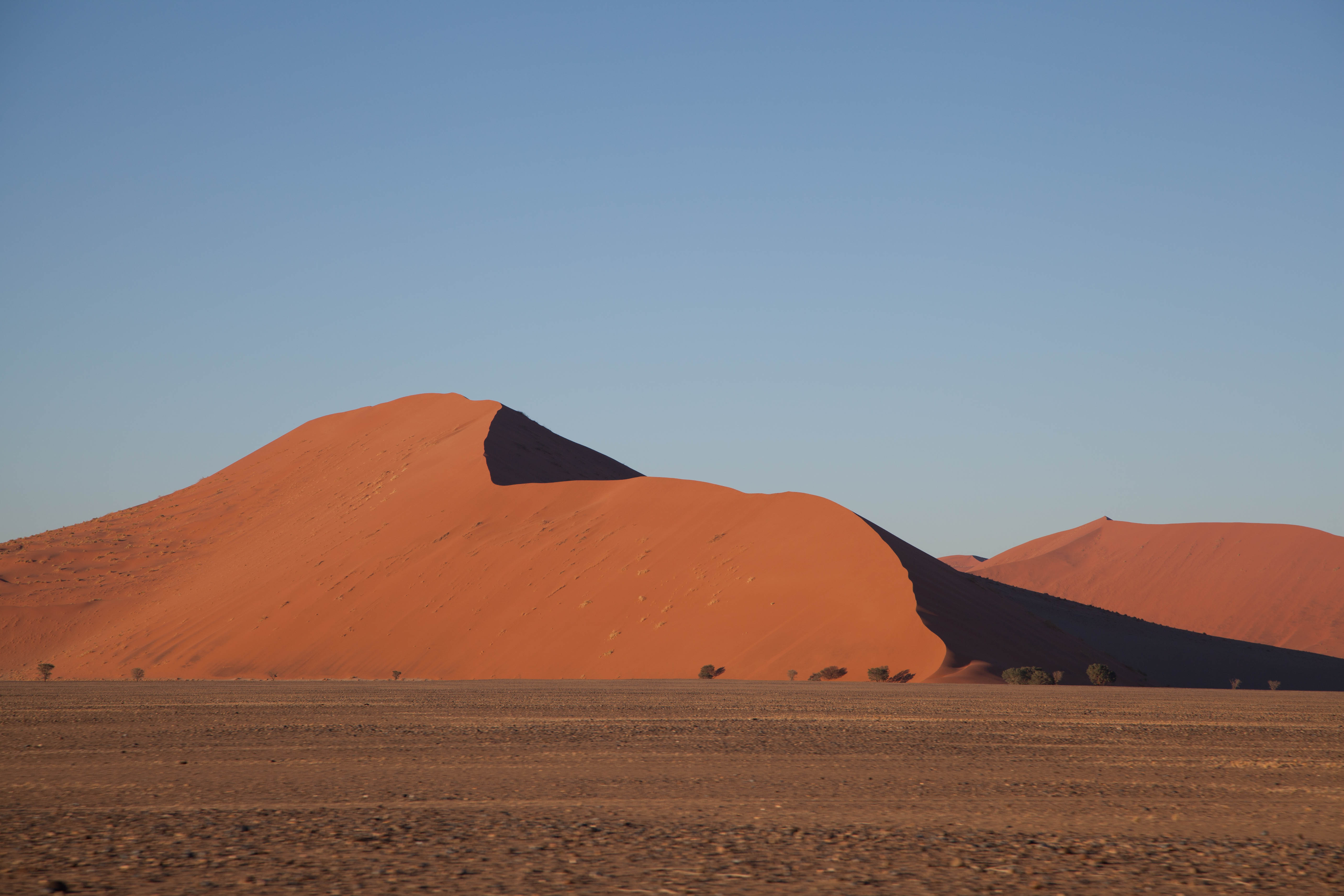
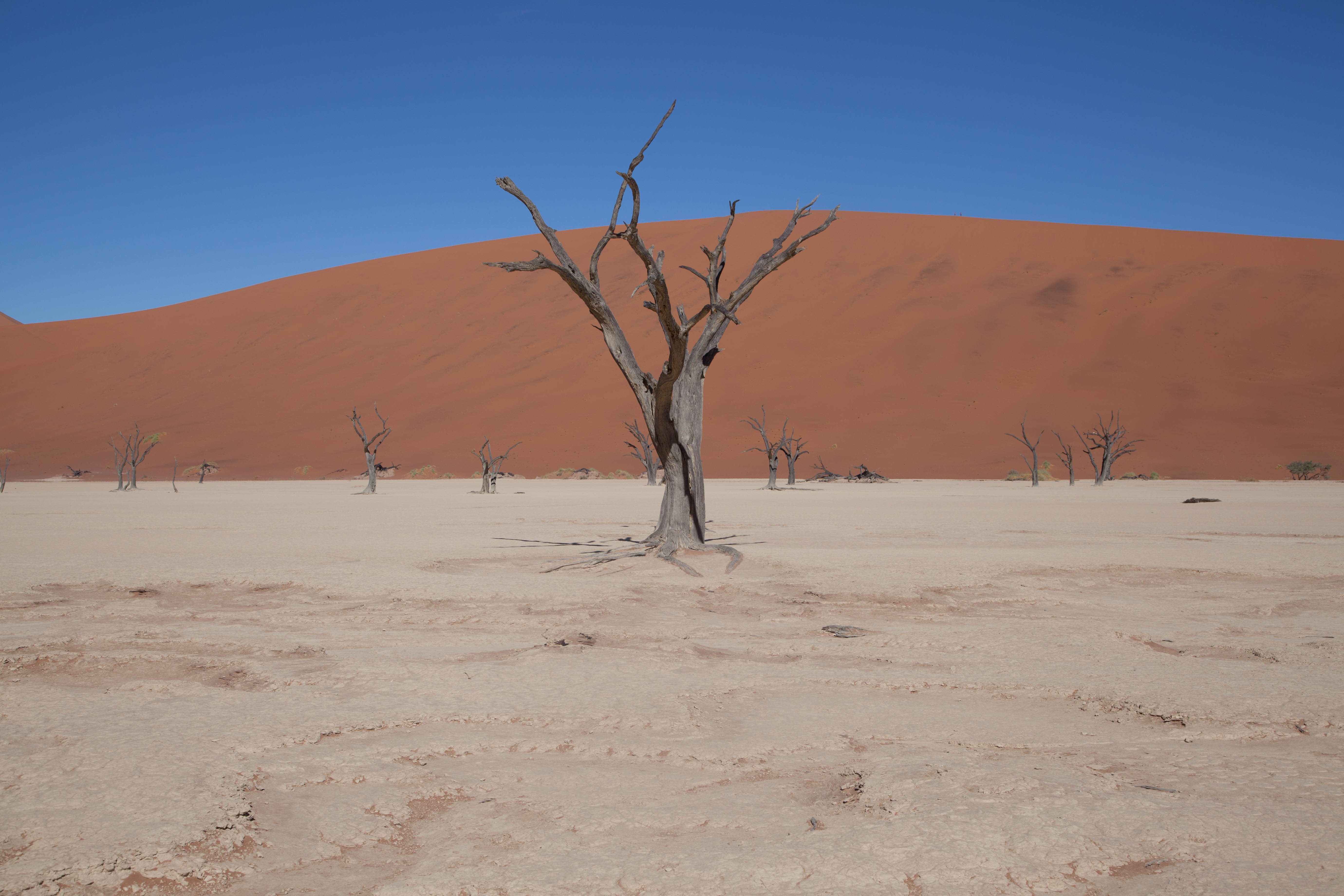
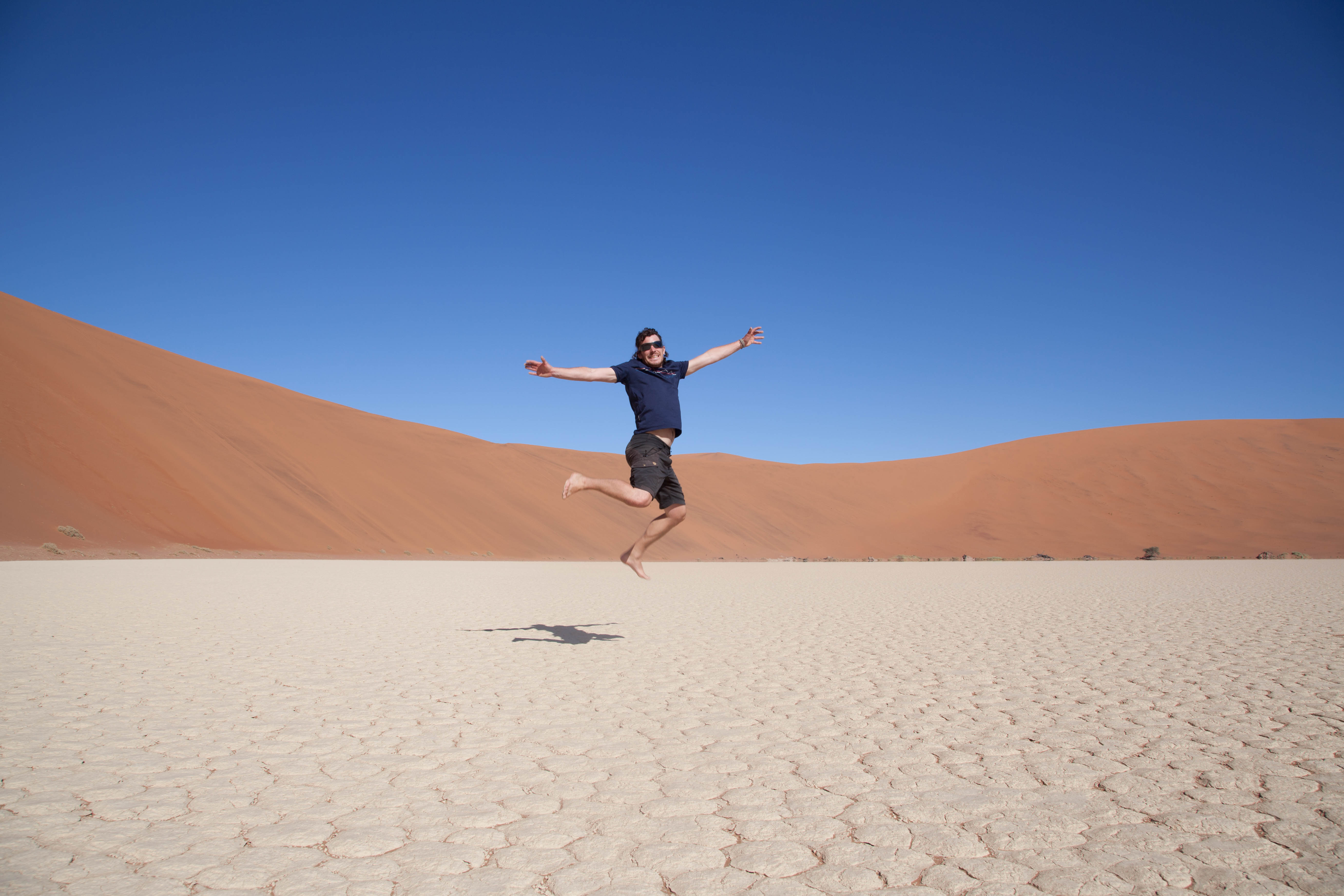
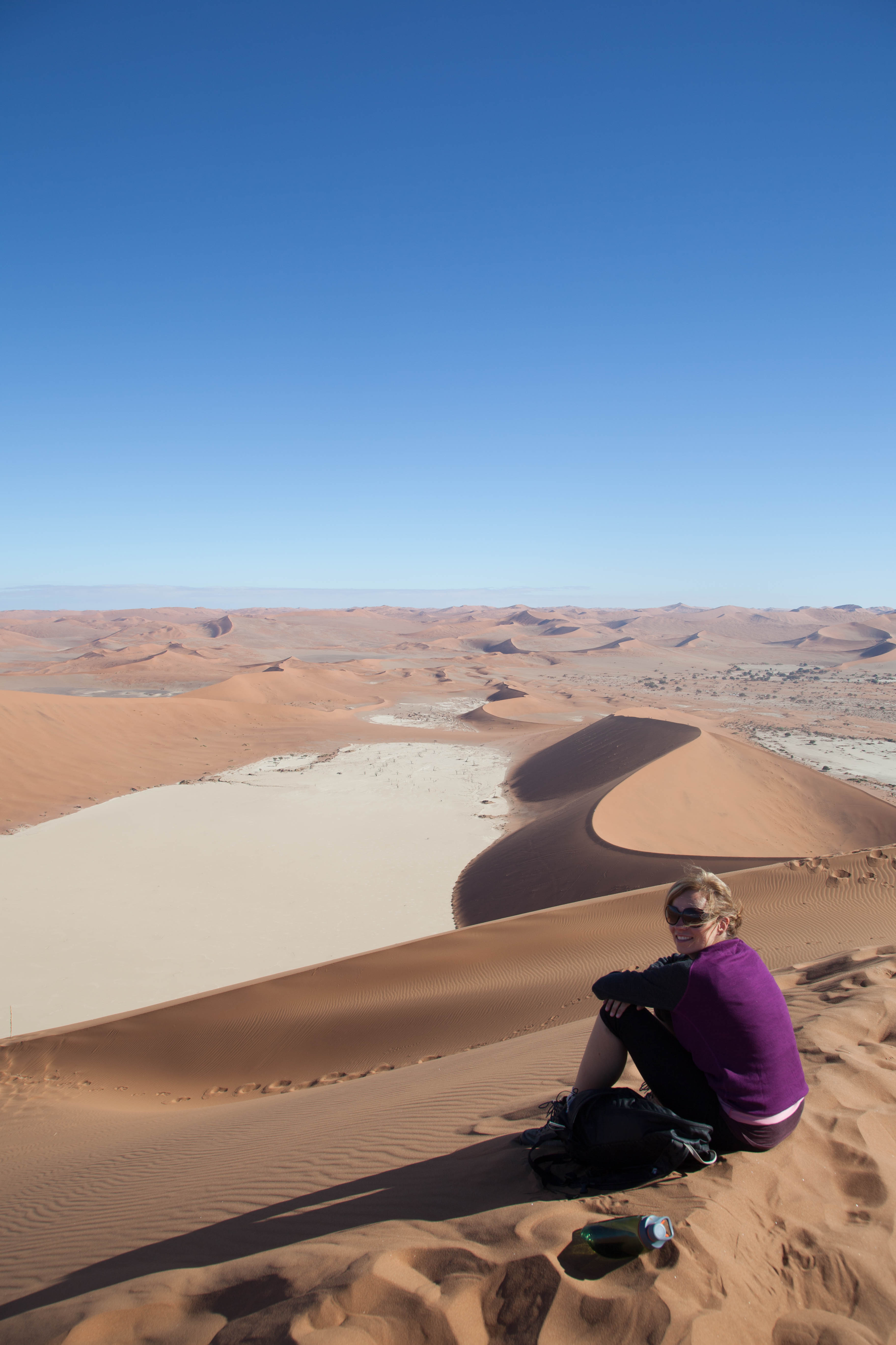
The emptiness goes on. Luderitz is a small village which is know for its diamant industry and early German settlement We stay here for two days, look around and enjoy the peace and quiet. It feels like the whole population of Luderitz went to visit family, because nothing is happening here. We leave Luderitz to go to Sossusvlei, a place amongst the sand dunes. Sometimes it gets a little bit of rain which will then run down the 700m high sandslopes towards the lowest point. A layer of clay will form on this lowest point which will hold the water like a sponge. It’s like an oases surrounded by sanddunes. Sossusvlei (sometimes written Sossus Vlei) is a salt and clay pan surrounded by high red dunes, located in the southern part of the Namib Desert, in the Namib-Naukluft National Park of Namibia. The name “Sossusvlei” is often used in an extended meaning to refer to the surrounding area (including other neighbouring vleis such as Deadvlei and other high dunes), which is one of the major visitor attractions of Namibia. The name “Sossusvlei” is of mixed origin and roughly means “dead-end marsh”. Vlei is the Afrikaans word for “marsh”, while “sossus” is Nama for “no return” or “dead end”. Sossusvlei owes this name to the fact that it is an endorheic drainage basin (i.e., a drainage basin without outflows) for the ephemeral Tsauchab River.
On our way to Sossusvlei we see a large yellow cloud coming towards us. As everything around us turns darker and we get closer we see that it’s a sandstorm. We turn our lights on and by the time it hits us, it is like we just passed a large truck doing 140km/h. We stop and wait for the dust to clear up. A couple of minutes later it’s like nothing ever happened and we’re looking at a clear blue sky again. On our way we see gemsbokken, springbokken, zebras and ostriches.
Back to all blogs
We go to sleep early and wake up to realise that AfrikaBurn is really starting today! During the whole day we see new people arrive and every spot where a tent could possibly fit is taken. We get some good coffee at the Alienz, a theme-camp that makes you a cappuccino or espresso in exchange for a compliment. Right next to the coffee tent is the Pancake Posse tent where we patiently wait for our pancakes while the volunteers are running around trying to serve everyone.Below we will try to describe the feeling of and ideas behind AfrikaBurn. Tickets: half a year before AfrikaBurn starts the tickets are up for sale. These 12.000 tickets are sold out quickly, months before the festival even starts. To be able to buy tickets you have to make a profile and fill in a questionnaire that makes you aware of the nature of the festival. In the weeks before the Burn, there is a re-selling of the tickets. People who bought tickets, but can’t make it anymore get a chance to hand in their tickets which will then be resold again for them by the organisation. Got tickets? Then it’s time to start thinking on how to get to the AfrikaBurn location which is in the middle of the Tankwa desert. It takes you at least 5 hours driving from Cape Town over a road that starts out as a tar road, but most of it is gravel, layered with a lot of dust. The dirt road is heavily corrugated and covered with sharp stones that are just waiting to empty your tires…Got transport? From the moment your drive into “Tankwa Town”, money is of no use. Advertising is prohibited and nothing is for sale (except for ice). You will have to be self sufficient for at least 7 days (food, water, camping gear) or hope for the generosity of others. You made it! What can you expect?I think the AfrikaBurn days are best described as a beautiful spring day, like the first warm day of the year. Slowly, the parks in the city fill up with people, but this time everyone is dressed up as if they are joining the Gay Parade. Everyone walks around with snacks, wine, rugs, skirts, umbrellas against the sun and happy faces. Unlike the cityparks there are activities all around. There is no set program so everyone walks, drives or catches a lift (on a mutant vehicle) until they find something they like. The diversity is immense, from art to theatre, dancing, music, eating, drinking, doodling, creating or just hanging around. These activities are offered by theme camps. These group camps are usually run by a group of friends and have a certain theme. A couple of examples: a hot outdoor shower, a spa, a library, a coffee tent, lectures, a post office, a pancake tent, making art tent and several places with Djs or bands playing.
At night some of the mutant vehicles and themecamps change into music platforms. The vehicles carry a DJ stand, lights and huge speakers. You just walk around until you find one that plays the music you like. The largest and most famous of these drive-around-Djs is the Spirit Train. The Spirit Train is a tractor with 5 carriages where the middle one is DJ booth. AfrikaBurn starts on a Monday and on Thursday night the first Burns begin. The small and large wooden artworks are set on fire while the public sits around in a large circle to watch. Most of these artworks are really build to burn, and you only see that when they are lit and the different sorts of wood burn at different times which makes for some spectacular sights.