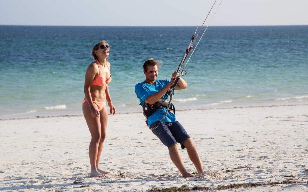
Het is inmiddels drie maanden geleden dat ik voor het eerst aankwam in Australie, 2 weken later volgde Helga en drie dagen later waren we onderweg naar een boerderij in Badgingarra, 250 kilometer ten noorden van Perth. Hier konden we gelijk aan de slag, oogst, schapen, reparaties en onderhoud. De werkzaamheden lagen voor het oprapen en waren erg afwisselend. Inmiddels hebben we alle factoren om ons heen kunnen verzamelen om te kunnen reizen en begint het te kriebelen. We ruimen de kamer leeg en pakken onze wel bekende tassen slordig in. Aan ruimte hebben we geen gebrek met de Toyota Landcruiser troopcarrier en morgen zullen we zuidelijk trekken op zoek naar het ongerepte en ruige Australie.
In de periode dat we in Badgingarra aan het werk waren hebben we een tripje van twee weken naar het noorden gemaakt. De route staat hieronder en de foto’s zijn te vinden in het foto album!
Het is eind november als ik de deur van de Toyota hard dicht sla, alles is ingepakt. De wolken sluiten samen als een dichte deken en de eerste druppel raakt me vol in het gezicht, snel volgen er meer. Heerlijk reisweer, we rijden de stad Perth uit en volgen de kust zuid.
Eaglebay, Margaret river, Augusta.
We zoeken het gezelschap weer op van een rondreizend stel. Twee jaar geleden zijn ze uit Sydney vertrokken en inmiddels zijn ze bijna rond Australië.
Warren NP, Shannon NP, Mt.
Toolbrunup, Fitzgerald River NP
We kruipen we nu in oostelijke richting langs de kust. We zetten de auto waterpas met een paar stenen, klappen de tent uit en met het zakken van de zon lijkt al het geluid te verdwijnen. We zijn alleen onder een heldere sterrenhemel.
Balladonia track
Moeizaam ploetert de auto zich door het zachte zand omhoog. Helga’s knokkels zijn wit, haar handen hebben zich stevig om het stuur van de Toyota geklemd. Het raampje aan de bestuurderskant staat half open, af en toe persen zich er takken doorheen die vervolgens schrapend over de zijkant van de auto verdwijnen. We stoppen als omgewaaide bomen het pad versperren.
Port Lincoln, Coffin bay
De zon gaat onder en kleurt de lucht rood en paars. De vinnen van dolfijnen snijden door het water, vanaf de door de zon eerder opgewarmde stenen bekijken we het schouwspel dat duurt tot het laatste licht. Met een kampvuur halen we de warmte en het licht weer terug. In goed gezelschap beginnen we een nieuw jaar.
Nuttbush Retreat – Port Augusta
Een gevoel van herkenning is er als we aankomen op een sheepstation. De voortrazende roadtrains bulderen door de stilte. In combinatie met het zachte hoge herkenbare gezoem van muskieten houd het ons die avond in een lichte slaap.
Melbourne
Geuren van ondefinieerbare, maar vast goede gerechten vinden zich een weg door je neus. Mannen laten hun gezichtshaar staan, lopen in korte broeken op kleurige sportschoenen en lijken druk onderweg naar iets. Vrouwen trekken hun broeken op ver voorbij hun navel, rood geverfd haar is hip en zichtbare geïnjecteerde inkt is meer gewoonte dan uitzondering.
Leaving Melbourne was long awaited but sad. We would finally be on the road again after spending almost 7 months working and preparing the upcoming trip in one of the greatest cities we’ve ever lived. We met wonderful people, drank the best coffee and enjoyed the hustle and bustle of city life. But it was time. Time to feel our beloved Troopcarrier work beneath us to bring us from A to B, time for campfires, time to sleep up high and time to see more of this amazing country.
It took us two days to pack the car. Reen once compared packing his motorcycle panniers as a game of Tetris. Well, this was Advanced Tetris. With the barrier we had installed behind the backseats, some things were a little bit more difficult to fit in and we had acquired a lot more stuff.
In the end, we managed, but knew we would probably repack at least 5 times before everything had its right place.
We left Melbourne in the pouring rain. The city was obviously weeping for our departure.
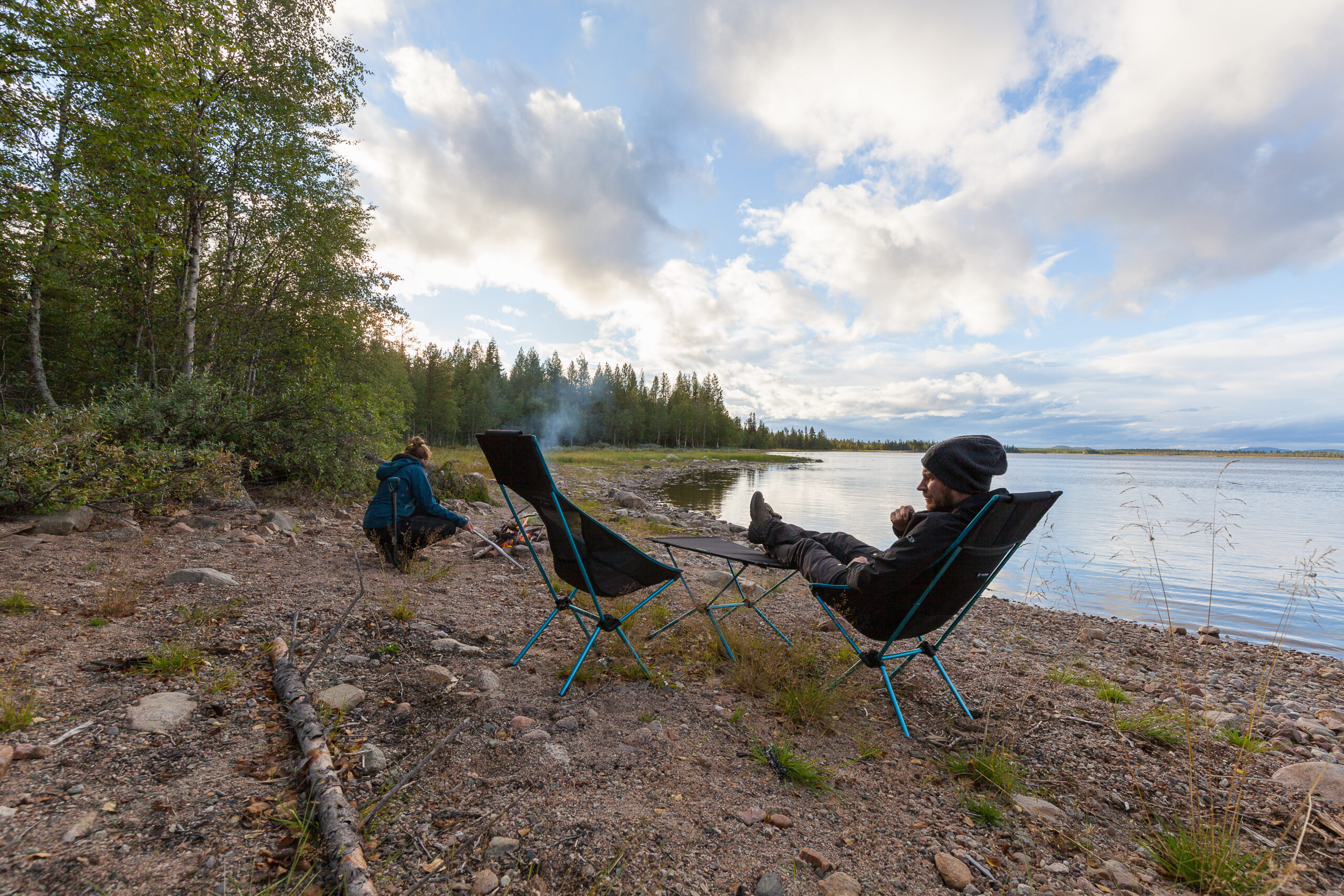
Giddy for being on the road again we listened to Abba and drove all the way to Lake Eildon. Mt Pinninger provided us with a beautiful campsite and we were glad the rain stopped when we were pitching up the tent for the first time in months.
The next two days we drove through Mansfield, camped at Edi, moved on to Myrtleford, Bright and camped at the beautiful Mountain Creek Campsite near Mt. Beauty.
We decided to do some 4 wheel driving and took a short cut to Mitta Mitta on Disappointment Track….which turned out to be a real disappointment since the road was blocked by an enormous tree. Turning back was the only option unfortunately. Where is that chainsaw when you need it?
To drive from Corryong to Kiandra was a challenge. The high altitudes in Kosciuszko National Park and the fact that it is still winter resulted in closed roads, campsites and Park entrances. Long winding roads and even snow on the side of the road gave us the distinct feeling of driving somewhere in Europe and we had to drive well into the evening before we found a place to camp at Yarrangobily.
Waking up the next morning I looked up and couldn’t believe my eyes: frost! on the inside of the tent. Reen hurried out of the tent to take photos of the unbelievable winter scenery of frost and ice.
We decided to take the advice of our fellow camper and head over to the Thermal Pool at Yarrangobilly Caves and indulge ourselves with 27 degrees bath in the outdoors.
All refreshed we began our longest drive in 5 days. We wanted to reach the Blue Mountains that day since my parents arrived there that day too.
I would’ve loved to know how many kilometers we drove that day, but both my iPhone cables decided their life had come to an end and my Hemamaps app only tracked for an hour before my phone’s battery gave out. After a long and boring drive on the Freeway we arrived, exhausted, in Leura (the Blue Mountains) where my parents were waiting for us in a nice apartment.
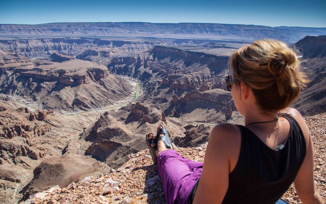
Over the past few days we’ve seen many stunning views and walked beautiful tracks through canyons and over high cliffs. So far the Blue Mountains have not disappointed us and we’ll enjoy its riches for a few more days before my parents go back to a currently rainy Holland and we’ll continue up the coast.
After we drove my parents back to Sydney (driving on the “wrong” side of the road not being their thing) and spent a whole 5 hours being tourists we took a train back to the Blue Mountains to pick up our car.
That first night alone again we stayed at a deserted campsite in the Blue Mountains near Woodford.
From there we drove from Dharug National Park to Yengo National Park and from Yengo to Barrington Tops. Our timing was really unlucky since all of the 4×4 tracks in Barrington were closed until the 1st of October……
A little frustrated with this we camped at Manning river and made a nice fire to ease our pain. We were really close to Gloucester then and we went to see our friends at the company Drifta. They helped us sort out our crate-storage problem by making a wooden frame for them. Happy to have this sorted out we decided to head for the coast.
The moment we left Gloucester it started to rain……and hail…..and rain some more. From Port Macquarie we took a “road” towards Point Plomer. That road had so many potholes (filled with water from the still ongoing, never to stop, rain) that anything above 5km/h was impossible. Frustrated and tired we spent a night in the pouring rain and thought we would try our luck inland the following day. We drove towards Wollomombi Falls (still raining), camped here and there (rainy) and took the Waterfall Way back to the coast (RAIN).
So apparently, the New South Wales coastline is really spectacular and worth seeing….but not when it’s raining.
Currently hiding out near Lismore with Ben & Sigrid (who we traveled with through WA & SA), we’re waiting for the weather to turn and hopefully enjoy the coastline with a little bit of sunshine.
Fraser Island: Exploring the World’s Largest Sand Island
It’s 5 o’clock in the morning when the Kookaburras wake me up.
I turn around in my sleeping bag, but I’m already too excited to go back to sleep.The day before a long, sandy 4wd track through Cooloola National Park prepared us for Fraser Island, which is only a mere 50 km ahead.
I stick my head out of the rooftop tent and the humid air startles me. I pull back immediately, but it’s too late: mozzies, having waited for their chance to come in, find their way through the now open mosquito net. Alright then, I think – they’re in, I’m out. Twenty minutes of hurried packing later and we’re on our way to Inskip Point.
The sun just doesn’t want to join us this morning. Inskip is covered in a thick layer of fog which doesn’t make it any easier in locating the barge on an unfamiliar beach.
When we finally get there we are guided to one of the three rows of cars already there. This is where the separation is made: all 2wd cars stay behind while only 4wd cars are allowed on Fraser Island. Our Toyota Troopcarrier should feel right at home.
Since it’s only ten minutes to get to Fraser we leave the barge still in the thickest of fog. We’re glad another Landcruiser takes the lead and we follow him on the hard sand which almost resembles bitumen. We can barely see the thick waves rolling in and the start of the low tide gives us enough space to drive along side them. In the distance we can see the outline of a the Maheno Wreck. The sun finally won its war against the fog and we get out the camera to capture this amazing scene.
That first day we drive all the way to Marloo, past Orchid Beach, and hide behind a small sand dune where we set up camp. We enjoy the sunset which is on the other side of the island, but still leaves a beautiful colour palette to our sea view.
The next day we drive back to K’gari where we start the first 4×4 track on Fraser Island: the Northern Forest Scenic Drive. Knife blade Lookout gives us a view over an enormous sand blow where you can almost feel the battle between sand and bush. We slowly continue on the track where the vegetation gives the eerie feeling of driving through a tunnel. I feel like I’m on a fun fair going through a haunted house: the branches are like cobwebs and the vegetation becomes a dark tunnel.
An oncoming car suddenly appears from around the corner on our single track. My foot is on the brake immediately and my adrenaline rush makes me go to lean on the horn before putting the Troopy into reverse to create some space to pass. The other driver waits while I make some space for him to to continue, after which he smiles meekly while he passes in a hurry to get away from us. It takes a while for us to get out of the adrenaline rush, but fortunately Lake Allom is close by, and a swim in the freshwater lake calms us down.
On the last few kilometers of the track we come across a deep ditch on the left side where the soft sand almost doesn’t allow us to level the car through it. We make it out of there unscathed after we reverse and try again – driving off-road on Fraser Island is not always a walk in the park.
That night we camp at Eli where the howling winds and the lack of sand dunes keep us awake for most of the night.
The next morning we drive from Eli via the beach to Eurong, and from there we drive a sandy track to Central Station, where we meet road workers placing rubber mats on the soft sand. We set up camp amongst the trees and decide to do the return walk to Basin Lake for a quick dip. We like our hidden little spot so much that we decide on another night and a long, 18 km walk the next day which will take us to Pile Valley, Lake McKenzie, Basin Lake and back to Central Station. It’s a long and testing walk and by the time we have reached Basin Lake it starts to pour down with rain. Luckily we know the way from the day before and we almost break into a run the last kilometers to get to the car. Not that it makes any difference, we’re soaked anyway.
It keeps on raining through the night and we have to pack up a wet tent and annex the next day. We take the Southern Lakes Scenic Drive to Dilli Village and continue via the beach back to Hook Point. We timed the trip back with the low tide and it seems like we’re not the only ones trying to get of the island. We join the long queue of 4wd cars waiting for the barge to take them back to the main land and from there we continue our journey around Australia.